

One Day Hike to Irshalgad: A Needle Head Pinnacle


Irshalgad Fort Detail:
Height: 3700 ft.
Nearest Railway station: Panvel/ Karjat
Landmark: Chouk Railway
Station
Base Village:
Irshalwadi village
Best time to Visit: September to February
How to Reach Base Village (Irshalwadi)
·
Catch a Panvel local train (Harbour line) or
·
Catch a Karjat fast local train to Karjat
station
From Karjat/Panvel to Chouk railway Station
·
ST Bus available
·
Direct private vehicle
· Distance one hour walk from Chouk railway station to Irshalwadi village
Hikers coming from Pune:
·
Get down at Karjat
·
Catch ST bus: Karjat to Chouk railway station
·
10.3 Km by road Karjat to Chouk railway station
·
Distance one hour walk from Chouk railway
station to Irshalwadi village
My Journey to Irshalgad Fort

When the
Nomad adventure approached me for this trek, I confirmed my participation as it
was happening on weekend and it is a good one-day hike to get back to the hill
and rural village settings. It was a lazy Sunday morning and we took an
early morning crowded Karjat train from Thane.
Organizers have arranged two private cabs for us from Karjat and dropped us at Morbe dam road near a small village. It took nearly half an hour to reach. It is around 10km from Karjat. Chowk is a small town on the old Mumbai-Pune national highway. You can also come from Panvel as well. The distance from Panvel to Chouk railway station is around 18 km. Our organizer has offered us a simple ready to eat breakfast at an open space near the village. There are few houses beside the road. If you are driving your own car, you can park your car there and request the last house owner to look after it and pay some incentive. They acknowledge our request most of the time.

From Chouk, we have to cross the railway track and walk up to Morbe dam road. We started our hike after the quick breakfast. The trail passes through Nanivali before climbing uphill to Irshalwadi (base village). We came across a big flat stone after 20 minutes of climbing. A good spot to rest and catch-up our breath. We could see a good view of the Morbe dam as well. After one hour of ascending the three hillocks, we reach the flat surface which is the main base village called Irshalwadi village.

In monsoon, the route becomes muddy and slippery till the base village. Our trek leader Yeash and Druvin greeted and interacted with the few villagers and we got to know that they do offer a stay and food facility.

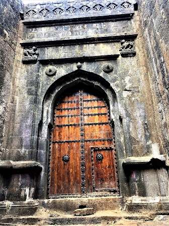
We moved ahead from the base village and walked towards the left side of the village school through the village. There is a small Irshal Devi temple on the right side and we had to walk straight. After the village the terrain becomes rocky. After a few minutes of ascending the rocky patches, we reached the main base of the Irshalgad pinnacle.

Almost there.Catching up breath
You can see the beautiful surrounding views and
good space to rest and take pictures. But in Monsoon, Irshalgad is mostly covered
with clouds. So you may not get to see the views some times. I have also
noticed that many hikers return back from this point after enjoying the view,
lots of selfies, and refreshments. They don’t climb up to the top.
Especially during the monsoon, it is a bit risky to climb up to the top during
heavy rainfall. The visibility level is very low and rocks become extremely
slippery.

After a good rest, few of us decided to climb up to the top. Some they refused due to fear of height and not comfortable climbing. Our trek leader took us to the left side of the route. We saw one big piece of stone had fallen down on the other boulder due to which the route was blocked. It seems that this happens mostly during the rainy season. Luckily nobody got hurt it seems. We just have to bend ourselves to go under the small hole.

That route has led us towards the ascending point to the top. The problem here is, I observed that hikers climb very close to one after another. That is pretty dangerous. If one loses grip and falls down, you can imagine what will happen to the people who are climbing after that person. This happens when there are many hikers in the queue. They are in a hurry to climb by ignoring the risk factor. Luckily we were the second group to climb up because we had started our hike early.

We had to climb a steep rocky patch to reach up to the first water tank and towards a small open temple at your right side. From this point, you have to climb a shaky short wooden ladder towards the top. Here you have to climb that ladder cautiously as the ladders are loosely tied. After a short vertical ascends of the wooden ladder, we reach up to the Needle head rock point which is usually seen from the base village.
Image credit: Gautam Vaishnav

We headed further towards the left side and could see one more rock-cut water cistern was there. Finally, our leader told us that this was the top of the fort and we can’t go beyond this.

We spent some time enjoying ourselves and lost ourselves in the beautiful surrounding views. We could see the view of the dam as well. That is the greatest reward we get every time whenever we summit any hill or mountain. We looked at the beauties of nature and purified our souls. We are not supposed to climb an 80-degree pinnacle without the proper gear and professional support. Villagers told us that one hiker died due to an accident.

We
descended quickly before others and quickly joined the group. We had some good
bonding time by sharing our snacks and juices. We posed together for a group
picture before we started descending back to Chouk. The Irshalgad is an easy
and perfect one-day hike for any hikers or nature lovers for the post
Monsoon.
TIPS:
- Wear a good hiking shoe/ sports shoe
- Wear a comfortable dress. No denim, please
- Carry your pack lunch and snacks
- Carry water bottle minimum 2 litters
- Wear a good rain jacket if you are going in Monsoon
- Avoid hike to Irshalgad during the peak of monsoon
- It becomes very slippery and low visibility
- Leave the trail behind not the trash. Bring your trash back to the city and dispose of it in a dustbin.
- Be sensitive towards the villagers when you are interacting with them.
- Respect the culture and the heritage of the site.
- Do not play loud music. Listen to nature’s sound.
- Be a responsible hiker


No comments: