ALANG, MADAN, KULANG FORT (AMK) : MOST CHALLENGING SHAYADRI TREK
Alang Madan Kulang (AMK) forts are near Igatpuri in Nashik district, Maharashtra, India. It lies in the Kalsubai range of the mighty Western Ghats. AMK is considered as the most difficult trek in the Sahyadris, Maharashtra as it includes multiple steep climbing, Rappelling, Rock climbing, and many risky patches. Thrilling traverse and dense forest cover and steep rock cut steps make this trek more difficult. It requires technical support from the local expert. This trek is a real test of your mental & physical stamina, confidence, balancing skills, and endurance. It is not advisable for beginners and people who have vertigo. All three forts stand high with a height more than 4800 ft which gives a breathtaking view from the top.
How to Approach AMK
This trio fort can be approached from 4 different routes. Ambewadi...Kulangwadi.Samrat and Ghathgar village.
Difficulty level: Demanding
Endurance level: High
Duration: 2 / 3 days
Distance from Mumbai: 140km
Best time to visit: September to December and February to March.
Our 2 days trek Itinerary:
- Base village: Ghathgar Village
- Hike to Alan Fort
- Explore Alan Fort
- Move to Madan Fort (afternoon)
- Quick lunch on the way towards Madan Fort.
- Ascending Madan Fort
- Hold night at Madan Fort top
- Descending Madan Fort
- Have breakfast
- Ascending Kulang Fort
- Descending Kulang fort
- Good lunch
- Trek ends at Ambewadi.
AMK trek was there in my top list for a long time. I could not pursue it earlier due to other commitments and time issues. I have been hiking in Sahyadri ranges for the last 8 years and explored almost all the famous hiking spots in Sahyadri except AMK and a few other spots. It has also become my favorite weekend escape from the hectic and stressful city life. Finally I thought the time has come for me to pursue this trek. Therefore I was waiting for the right organizer and the right time to do this trek. I was totally prepared for this trek physically and mentally as well.
Luckily, one of my hiking partners informed me about the Sahyadri Rangers AMK trek. I immediately collected the details and registered myself. I got good reviews from other hikers too.
I was pretty excited that my AMK trek was finally happening under the leadership of young, experienced, and dynamic trek leader Akash Goswami and Local technical support Ganpat Bhao and his team.
My trek leader has planned to cover all the three forts within two days. Hence we are going on the Weekend. Some groups cover all the three forts in three days and some just visit only Madan or Kulang fort for overnight stay. However, most of them have preferred two days to explore all the three forts due to time constrain and food. There is no Dhaba to buy the cooked lunch or dinner, Our local guide has to arranged enough ration for two days and have to cook or we have carried by ourselves. All three forts have many rock-cut cisterns to accumulate and store the rainwater. Local guides use this water from cisterns for cooking. I personally found that Madan fort rainwater storage was a much better and cleaner than the other two. All the tree forts have good caves to take shelter in the night. Among the three, Madan is the most difficult to climb. due to many dangerous and risky patches on the way.
DAY 1 EXPLORING ALANG FORT
I took last crowded Kasara local at 11:34pm from Mulund to join the group which has already boarded from CST and Dadar. We reached Kasara around 1:20am. We have a total of 11 young, lively, and energetic hikers including the guide. From Kasara, we took a private jeep which took us to the base village (Ghathgar village). We reached the base village around 4am and rested there at our local guide house for some time and had our early breakfast.
We started our hike around 6am. It was a pitch dark. After 40 minutes of walk finally, we reached the bottom of the Alang fort. We took a pause for some time and rested for a few minutes and did a headcount by our guide. We gradually started ascending the Alang fort.
The initial climb was easy and the trail was well marked. Our local guide was leading us. We reached a flat surface after 45 minutes of walk. The visibility has improved and we could see a good view from the point. We paused here sometime and enjoyed the view and breath some fresh air.
We continued our hike and the trail leads towards more steep climbing and where we have to be a bit mindful of our steps. We finally reached a point where we have to climb the 80-degree iron ladder. That is the most difficult climbing point of the Kulang fort, otherwise, there is no technical climbing required. After almost one and a half hour climb, we reached the neck of the Alang fort.
The 80-degree iron ladder climb towards Alang fort
We were happy that our guide told us that, climbing part was over. From there, walk straits towards the Madan and Kulang side Fort (Left side) and we could see the Madan and Kulang fort clearly. We enjoyed the surrounding view. The trail took us through a rough rock cut patch followed by mild ascending and finally to Alang caves.
Alang cave. photo courtesy: Ustrekking
We rested there for half an hour and had our snacks to refresh ourselves and we were asked to keep our bags in caves and moved ahead to explore the Alang fort peak. The top of the Alang fort is a huge plateau. 2-3 hours are sufficient to explore the whole fort. The caves, water tank, remnants of few ruined standing structures to see.
Rock-cut cisterns at Alang Fort
We sat near the cistern and reflect ourselves.
Madan and Alang view from Kulang fort
We summit the peak of Alang Fort
We reported back to the caves after exploring the Alang fort within 2 hours. We were ready to proceed towards Madan fort. Our local technical guide briefed us about the Alang to Madan route and its difficulty level. We were supposed to hold a night at Madan fort.
Exploring Madan Fort
After the neccessary instructions, we started our journey towards Madan fort and it may take us around 4 hours to reach our destination. If there is no long queue at the rappelling section of the patch. Some times, we have to wait a lot of other hikers are descending at the same time.
The trail to Madan fort is straight and very adventurous. There are no sub trail. Descending is not easy and a bit challenging, as it requires technical support and the ropes to rappel down to the Col. Descending starts with the very sharp drop rock-cut steps where we need to hold a rope to climb down and then comes the rappeling part.
We wore all the technical gears provided by the local technical guides and rappelled down one by one.
Hence we all have some experience of rappelling except one girl. However, our local guides were very good and we managed to rappel down quickly. This is the most difficult patch. Especially if you are climbing up to this patch. There is no other way to descend or ascend.

50 ft. rock patch at Alang, (fully vertical)
We were quite happy that we did it quite smoothly with the help of our local technical guide. We proceeded further towards the Madan. The trail is pretty straight and walking along the neck of the Alang hills.
We
have come across some caves on the way and paused for a water break. After 40
minutes of walk, we have reached a gap between Alang and Madan fort where we
had our quick pack lunch. We re-energized ourselves after a quick lunch and
motivated for more adventure and challenge.
The trail
becomes narrow and dangerous, exposing the valley on the right side while we
ascending the rock-cut steps. Two patches require to fix a
rope and the local guide support to cross that dangerous patches where we have
to stick ourselves towards the wall and walk slowly by holding the rope.
There is no proper passage. It becomes difficult when you carry heavy backpack. It
requires lots of balancing and concentration.
1st risky patch. The steep wall of rock on one side and a deep valley on the other side.
Good balancing and sharp concentration help me to cross this dangerous patch without the help of rope. Exploring Madan is a real challenge and adventurous too. It demands lots of stamina and endurance to climb those long steep rock cut steps and crossing the dangerous patches and the 40 feet rock climbing without the jumaring equipment. We climb with ropes and little support from the local technical guide. This was a bit challenging as we were tired already but our guides pushed us through.
40 ft height another rock climbing patch of Madan
Finally comes the most dangerous patch towards the top. we have to climb the long, steep, zigzag, and narrow rock-cut staircase to reach the top. I was very cautious and mindful of my steps. One side is a sheer drop to the deep valley and there is no support. The steps were damaged. It says that the intruders have purposely damaged those steps by tanks. The person who has vertigo should not go to Madan fort.
Rockcut zigzag shape stair case
This patch is the most dangerous. Steep and narrow.No support on the other side.
We reached to the Madan fort top after crossing through so many difficult and challenging patches. It was already an evening by the time. Our local guide further took us to caves where we are taking shelter for the night. The cave was very spacious and it can accommodate more than 30 people. We entered the cave and our guide told us to choose the corner space and kept our bags and rested for some time. Slowly many other groups started coming within two hours the cave was full. There is only one cave in Madan fort. It was in December and very windy and cold outside in the evening and at night. We cannot afford to sleep in an open area.
After a good rest and some snacks, we explored the Madan fort. Madan was smaller than to Alang and Kulang. Madan cistern water was more drinkable than the other two forts has. We went up to the top of the fort and enjoyed the breathtaking view. We can clearly see the Bhandardara area and the Kalsubai peak.
A view from the top
We enjoyed the breathtaking view and sunset. Gradually becomes dark. We went back to our cave and
socialized with the other hikers in the caves.
Dinner time
Our local guide and his team had served a yummy dinner in the night. It was very windy and cold but we had our dinner with the torchlight. That was the best meal for the day. We went back to our cave and had a good interaction with the group and therefore we got to know each other better. The night was a bit congested cave was overcrowded with the different groups. Mumbai and Pune. We slept peacefully after a good interaction. We were asked to wake up early as possible so that we could leave early before the others as otherwise there will be a long queue for descending via rappelling. This will waste our time. Almost all of us woke up on time and got ready. I was pretty excited to explore the last fort that is Kulang. One of the highlights of the Madan fort was Sunrise view. So we all were packed our bags and ready with our camera to capture the moment. It was such a blessing to witnessed the magical sunrise and we could clearly see the kulang fort. That was a magical moment.

We descend the Madan after witnessing the sunrise. I wished I could stay more to enjoy the moments but we had a long day. We have to explore the last fort Kulang to explore and returning back on the same day.
Descending Madan via rappeling
Luckily we were the second group to descend Madan. No waiting and we quickly managed to get down. We reach a col between Madan and Kulang. There is one local shop. Selling water bottle, Lemon water, and some biscuits. Our local guide and his team quickly prepared our breakfast.
Breakfast: Poha+Tea (Traditional Maharashtrian breakfast)
DAY 2 Exploring Kulang
Basically, Half-day is more than enough to explore Kulang-top depends on the fitness of the
group. The view from the top is classic and breathtaking. My whole tiredness disappeared when I see the view from the Kulang top. We proceed further after the power breakfast. For 30 minutes the trail was straight yet uneven.
Before we begin our steep climbing, there is a patch, where we have to climb down a bit but the patch is very slippery due to dry mud. Here you need technical support. It is a bit risky to walk without any support. There are chances that you may slip and fall down and hurt yourself. We descent slowly with the help of rope. That is the crossing point from Madan to Kulang Hill. There we have to start ascending. Kulang has the highest climb from the base to the top. Very steep climbing is required to reach the top. We slowly started ascending Kulang after the short water break. After halfway through, we had to climb the steep rock-cut steps which lead straight towards the top.
Slippery patches where we took rope support to climb down to the bottom.
elevated steep rock-cut steps (oneway)
Rock cut gate and a small cave in the left near the entrance of the Kulang fort.
Almost there...
Main entry gate to the top.
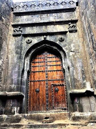
The entrance of the Kulang fort is still intact with the fortifications still standing along the edges of the fort. The rock-cut entry gate is still standing tall. The top of the Kulang fort is a big plateau. Towards the right side of the entry, there is a cave and remnants palace and many other ruined structures. Below the surface, there are few cisterns, etc. Towards the left side, there is a series of connected cisterns and open water tanks, disfigured carving of Lord Ganesha, a shiv-ling, The breathtaking view from the top is the most rewarding part. Kulang gives you the best views amongst two other Alang and Madan. Apart from Hikers, Kulang receives many groups for a picnic. They even come during the monsoon as well. Some times there is heavy traffic due to the picnic group. You have to be alert and start early.
Brief History of the Kulang Fort
The fort is located at an elevation of about 4825 feet in the Igatpuri region of Nashik and is considered as one of the oldest forts in the region as history goes back to the era of the Satavahana dynasty. It is believed that the fort was constructed by the later kings of the Satavahanas. However, the fort was later captured by many other rulers after the disestablishment of the dynasty. As per historical records, the fort has been ruled by Mughals and then by Marathas, and later on, the British Army.
Classic view from the kulang top
Cisterns ( rainwater storage system at Kulang )
Connected cisterns at the right side of the fort.
Remnants of palace
Ruined structure
After almost two hours of exploring the kulang top, we started descending back to the spot where our local guide team was waiting for us to serve the yummy lunch for us and we have kept our bags over there. We had our lunch and rested for half an hour. Finally, we have explored trio forts as per the plan. However, we are returning from Kulang to Ambewadi not going back to Ghatgat village. where we
started our trek.
Power lunch
We started descending after a good lunch and descending was pretty steep but not so difficult. After 2 hours of descending, we have touched the main road of Ambevadi village and our jeep was waiting for us. We were all very happy and proud of ourselves and we all came back with no injuries and successfully completed the most difficult trek in Sahyadri. We thank our guide Akash from Shaydri Rangers and Local guide Ganpat Bhao and his team. We congratulated each other before we got into our Jeep. On the way, we just hold a few minutes near the beautiful lake and enjoyed the view.
Our trek concluded at Kasara. We bid farewell to our local guide and took the Kasara Local to Mumbai. It is said that, when you meet people with the same passion, expect a miracle. Even though we are meeting for the first time through this trek but we immediately connected well and comfortable to each other. Most of them were young, full of life and there was never a dull moment throughout the trek.
Our journey becomes joyous and memorable when you have the right kind of people to travel with you. We completed the most difficult trek within two days with great spirit and fun under the leadership of Akash Goswami and Ghanpat Bhao.
Dynamic Group with a local technical guide Ganpat Bhao in the center and our trek leader Akash Goswami at the extreme left
Watch my action pack videos of AMK trek for more details.


No comments: